Urban Assignment
Einat Manoff, Environmental Psychology
Faculty Advisor: Cindi Katz
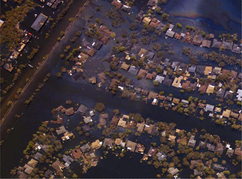
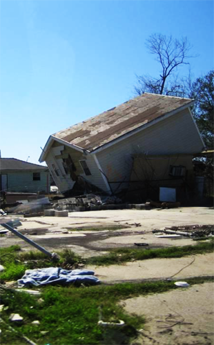
During my urban design fieldwork in Post Katrina New Orleans (2005-2006), I came to realize that cartographic data and spatial analysis maps were easily-manipulated tools used by principal institutions to promote their own agenda in the region. Since then, I have been contemplating the ways in which cartographic tools and available technologies can effectively evaluate changes in urban condition. My theoretical research investigates mapping, radical mapping and participatory mapping practices. I focus on the ways in which these participatory practices negotiate between communities’ spatial knowledge and more traditional, hierarchal, notions of spatial knowledge and spatial distribution. Additional Issues such as validity, global vs. rural, intellectual ownership vs. open sourced information will be explored in these contexts.
Stage 01: Digital-Visual Analysis
This stage analyses existing participatory mapping practices and explores the ways in which urban analytic tools and available technologies (such as GIS- Geographic Information Systems, Global Positioning System information, maps, high- and low-resolution satellite imagery) are currently used in a ‘bottom-up’ participatory manner. Since mapping has so rapidly developed from drawing to GIS and to Google-Earth, so have these transformations brought about social change and transformed the ways in which we represent and access spatial data.
Stage 02: Recording Change
This stage examines the ways in which these tools are used to bridge gaps between marginalized and isolated communities and are able to effectively communicate abrupt changes in urban condition.
Stage 03: Participatory Research Design
The main goal of Urban Assignment is to develop a digital-methodological mapping tool that can be used in participatory action research to generate critical, socially just and accessible spatial data. This tool will be based on existing practices of participatory mapping and on the previous stages of this project. It will empower marginalized communities to communicate their own spatial knowledge and become better equipped to respond to abrupt urban change.