Mapping New York City’s Sailortown
Johnathan Thayer, History

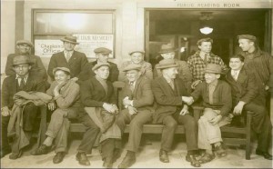
This project seeks to document the cultural palimpsest–the layers of material history embedded beneath the present’s surface–of the Port of New York, specifically Lower Manhattan’s port district circa 1890s-1940s. To do so, I will present digitized archival material representing printed handbills, pamphlets, journals, photographs, and more to “map” New York City’s “sailortown,” a term used to describe urban waterfront districts that catered to the transient population of seafarers constantly coming and going in between voyages at sea. Populated with boarding houses, saloons, print shops, nautical equipment purveyors, and ministry outposts, sailortowns were urban spaces where local workers, immigrants, reformers, and itinerant sailors met, interacted, and influenced each other—and by extension the urban environment surrounding the district. Because of the temporary nature of shore leave, sailortowns saw constant turnover in population and fostered a sense of “otherness” relative to the rest of the city—a characteristic of portside areas and seafaring culture which continues to shape the urban landscape to this day. Drawing influence from the shoreside maritime histories of Daniel Vickers and Judith Fingard, the framework for “littoral studies” put forth by Michael Pearson, and Isaac Land’s “Coastal History Blog” hosted by the University of Portsmouth’s (UK) Port Towns and Urban Cultures project, “Mapping New York City’s Sailortown” seeks to add to a growing body of scholarship dedicated to the study of cultural intersections at the city’s marginal shorelines, while presenting that scholarship to the public in a way that is accessible and engaging.